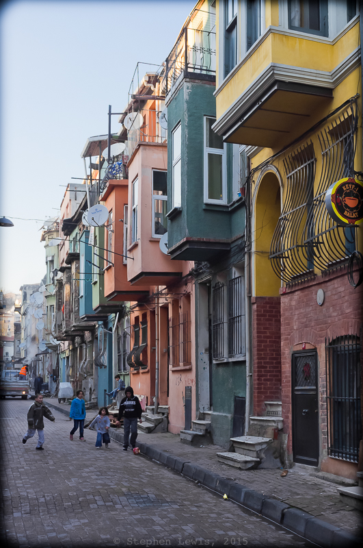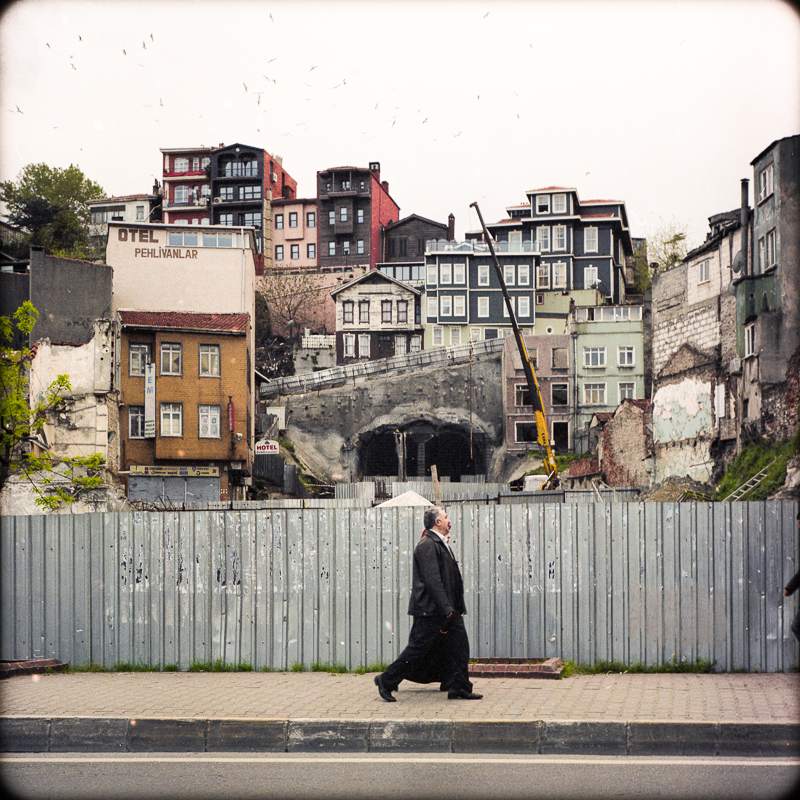
Street View, Kurtuluş, Istanbul, 2012. Fuji X100. Click to enlarge
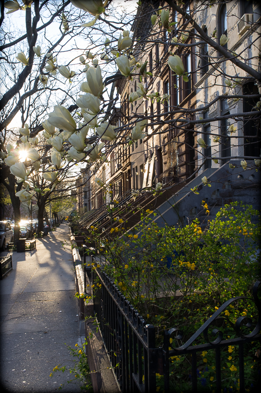
Three photos of three structures linked by geography and revealing facets of the dynamics that have shaped Istanbul: The row of apartment houses shown above stands on the crest of a ridge; the church and the construction site portrayed in the images below are set in the deep valleys that wrap around its lower reaches.
Tatavla
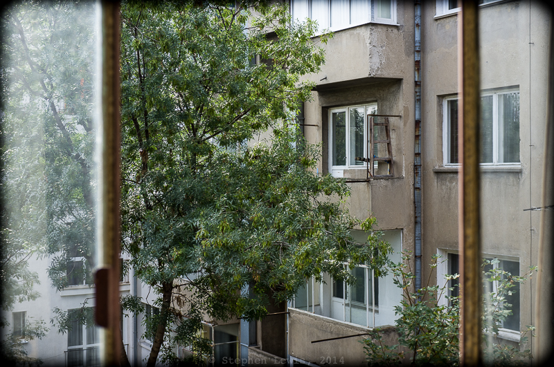
The apartment house row is located in Tatavla (present-day Kurtuluş) near the quarter of Bomonti, neighborhoods once largely Greek and still, in part, populated by Armenians and Jews. Tatavla was redeveloped at the turn of the nineteenth to the twentieth century when “minorities” of modest income began to move out of cramped housing in the Galata and Pera and the slopes below them and resettle in newly built dwellings in the heights beyond Taksim. The uniformly narrow frontal widths of building plots were determined by fire laws of the time in combination the economics of low cost housing. Building facades have been refurbished over and again as the decades passed, creating a stark geometry of plasterwork and stone. The streets are as prim and as quiet as they are treeless.

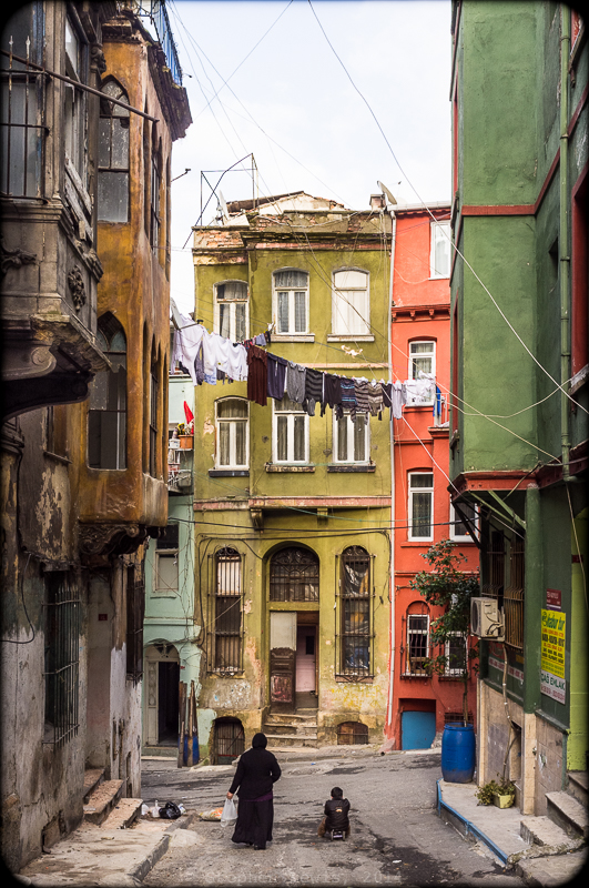
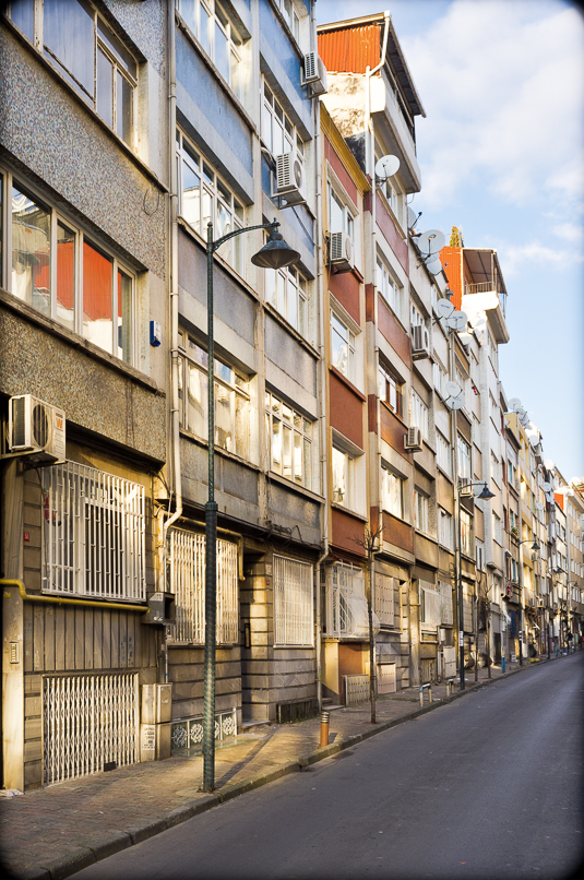
Facade, Evangalikos (Panagias Evangelista) Church, Dolapdere, Istanbul, 2012. Fuji X100. Click to enlarge.
Evangelikos
The church facade above is that of the Greek Orthodox Church of the Evangelikos (Panagia Evangelista), a huge eclectic structure combining a domed cruciform neo-Byzantine sanctuary with a neo-Gothic facade, a combination perhaps symbolic of the self-styled Byzantine roots and European aspirations of the community that built it nearly a century and a quarter ago. The Church of the Evangelikos stands in the valley of Dolapdere, one block from what is now a major traffic thoroughfare. Until recently, Dolapdere Boulevard was a rough and tumble street, by day home to automobile repair shops and ateliers producing window display mannequins and by night seemingly deserted and legendarily nefarious. Pedestrian traffic on Dolapdere is light but motor traffic is heavy and fast, and the church, half obscured by shabby storefronts fronting on the boulevard, is usually seen only in a mere flash from the windows of passing cars.
My guess is that the location of the Church of the Evangelikos was determined by two factors. First, like many Eastern Orthodox church locations, it was built adjacent to an ayazma, a sacred natural spring. Such streams have been holy to pagans and to Christians and to heterodox Muslims and dervishes as well, and have determined the sites of many other churches and one-time dervish monasteries throughout Istanbul. The second locational factor may have been more mundane but no less universal — cost. In inland parts of Istanbul, real estate prices traditionally are higher atop breezy crests and the upper reaches of slopes than in the less-well-ventilated, vista-less confines of valleys and former riverbeds .(Note: this rule is reversed at in the city’s coastal locations, where sea breezes and waterfront access and vistas have long commanded premium prices.)
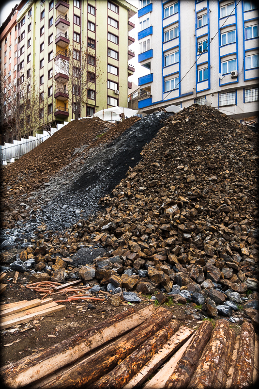
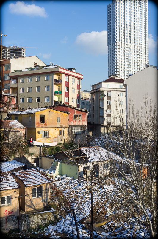
Construction site preparation, Bomonti / Piyale Paşa, Istanbul, 2013. Panasonic LX3. Click on image to enlarge.
Bomonti to Piyale Paşa below
The construction site pictured in the last of the three photos links back to a story I posted a year ago reflecting on development in Istanbul and the politics and values of hillside locations and views. At the time, the newly built middle-class dwellings in the upper reaches of the photo enjoyed views unobstructed by the shanty town below. In the present photo (taken in 2013), the shanty-town dwellings have vanished and site preparation materials for new blocks of flatsare laid out in artful cascading swirls. By 2014, the new flats were in place, leaving windows and balconies of the blue block shrouded in perpetual shadow, their views limited to the rear walls and windows of the newer buildings in front of them, from which they are now separated by a street of only medievally narrow width. In urban contexts, views and vistas are ephemeral and limited in time and reach, this is even more so the more modest one’s means and apartment.