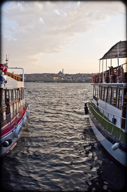
The Golden Horn from the boat dock at Kasımpaşa. In the background, the Mosque of Sultan Selim Yavuz, 2012. Fuji X100. Click on image to enlarge.
The Golden Horn: (Halıç in Turkish), a long, narrow body of water — an estuary actually — that, wedge-like, splits into two the core of the European side of the inner city of Istanbul. In Byzantine times the Golden Horn served as a safe harbor, shielded from currents and the depredations of raiders. In times of danger, an iron chain barrier was stretched across its entrance-way, providing security that in the end proved illusory (in the face of not being able to sail into the Golden Horn, 15th-century Ottoman conquerors simply dragged their boats up and down the surrounding hills entered the Golden Horn from its banks).
From Harbor to Relic
In Ottoman times, the Golden Horn was a gateway to docks, wharfs, entrepôts, and workshops that lined its length and to the thriving markets on the slopes above it. By the early-twentieth century, as manufacturing functions moved further afield and maritime traffic increased and ships grew in size, the harbor function of Istanbul was displaced outward, first to nearby Karaköy, then to the late-19th-century Anatolian rail-head at Heyderapaşa. Later, as Istanbul sprawled far to the east and along the shores of Sea of Marmara, the harbor function shifted even afield to new lower-density industrial zones and truck traffic transfer nodes offering proximity to highways and ample space for handling containerized freight.
From Conduit to Barrier
As its utility declined, the Golden Horn changed from a conduit to an inconvenient barrier to be traversed. By the start of the 20th century, a floating pontoon bridge across the Golden Horn facilitated movement to and from the commercial neighborhoods of Galata and Eminönu on opposite sides of the mouth of the Golden Horn. By the end of the century, the pontoon bridge was replaced by a fixed structure and two additional bridges had been built, one for local automotive traffic and the as part of a ring-road highway bypassing the inner city. Last year, a fourth bridge, for pedestrians and Istanbul’s growing underground metro system, joined their ranks.
Axes of Infrastructure and Subjectivity of Trajectories
Recently, I’ve been doing some longer-form writing on the subjectivity of our mappings of urban geography and on the effects that radical changes in axes of public transportation have on our trajectories, imaginings, and horizons. As a user (as well as an observer) of public transportation, the opening of the metro bridge and the axis of underground transportation it enabled, suddenly allowed me to move in only minutes between locations that had once taken an hour or two to reach. Now, I can visit in a single morning or afternoon I can visit parts of the city that I previously had to schedule for separate days. Better yet, I can now jump back and forth between disparate worlds. The new metro line transcends social disparities and well as space. Stylish Nişantaşı and working class Fatih, physically at opposite ends of the city, geographically and in terms of worldview are now neighbors time-wise. The Istanbul of traditional religious faith and economic activity is now of a piece with modern, secular, high-tech and high-income Istanbul. Rapid public transport across Golden Horn creates a breach an aquatic and cultural “Berlin Wall” I look forward to observing the outcomes.
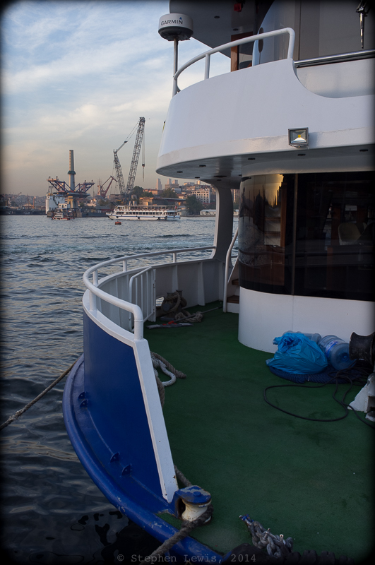
The Golden Horn from Eminönü, 2012. In the background, the start of construction of the Halıç Metro Bridge. Fuji X100. Click on image to enlarge.
Photographic Postscript
Framing…
These last days, while commuting back and forth between the Asian and European halves of Istanbul — a city of broad waterways, vistas, and dramatic light reflected on strong currents — I’ve come to long for the telephoto lenses I’ve usually eschewed. For years, “normal” or near-“normal” focal-length lenses — 80mm on 6×6, 135 on 6×9, 35 and 50mm equivalent on APS — have been the longest that I’ve used. None of these lenses enable me to transcend distance, compress perspective, or pluck far-away subjects from their surroundings. My “work-around” has been to frame faraway subjects within the contours of serendipitously present foreground objects. Not the best solution, perhaps, but one that can result in unusual compositions and juxtapositions as well a consistency in “language” of perspective and field of view.
Earlier this week, an acquaintance of many decades, Doc Searls, posted a nice weblog post featuring images and quotes from my recent entries on Bubkes.Org. In his commentary, Doc suggested that horizontality is the defining characteristic of human perception and, with this, of photography as well. I disagree … I’m a partisan of the vertical.
To continue reading (about squares, oblongs, verticals, men, and pumpkins) click here or on the “Read More” button below


